Increase sales in stores near Hospitals
Spot the whitespace, size the demand, and plan the coverage — across all 17 regions of the Philippines, on one living map.
Bring a question. Leave with a decision.
Retail intelligence, market intelligence and route optimization — answered the way your team actually asks, with live data on the screen instead of last quarter's slide.
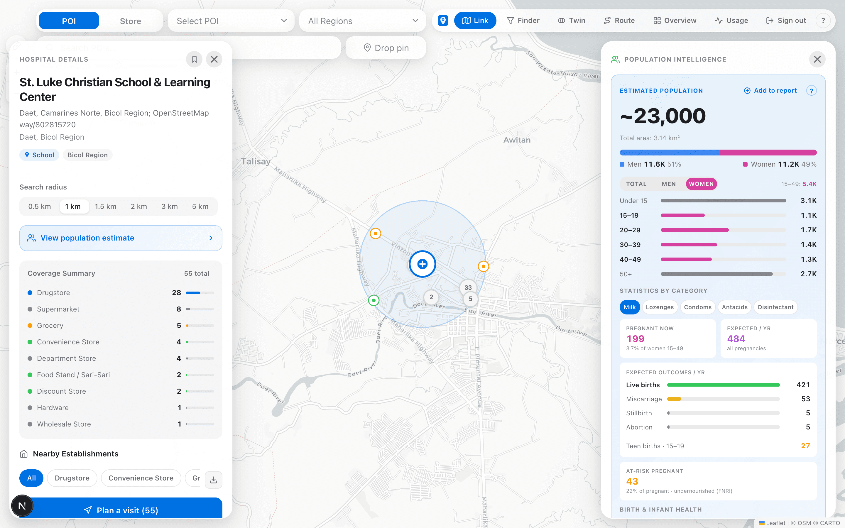
“What's really around this account — or this whole town?”
Atlas Link is the living map at the centre of everything. Drop a pin on any account, store, town or territory and the whole trade picture appears at once — every store and outlet nearby, the places that pull footfall, and exactly who lives in the catchment.
- Search any place and read its trade area in seconds — no GIS team.
- See the population, age mix and buying power around any pin.
- The map every other tool builds on — start here, then drill anywhere.
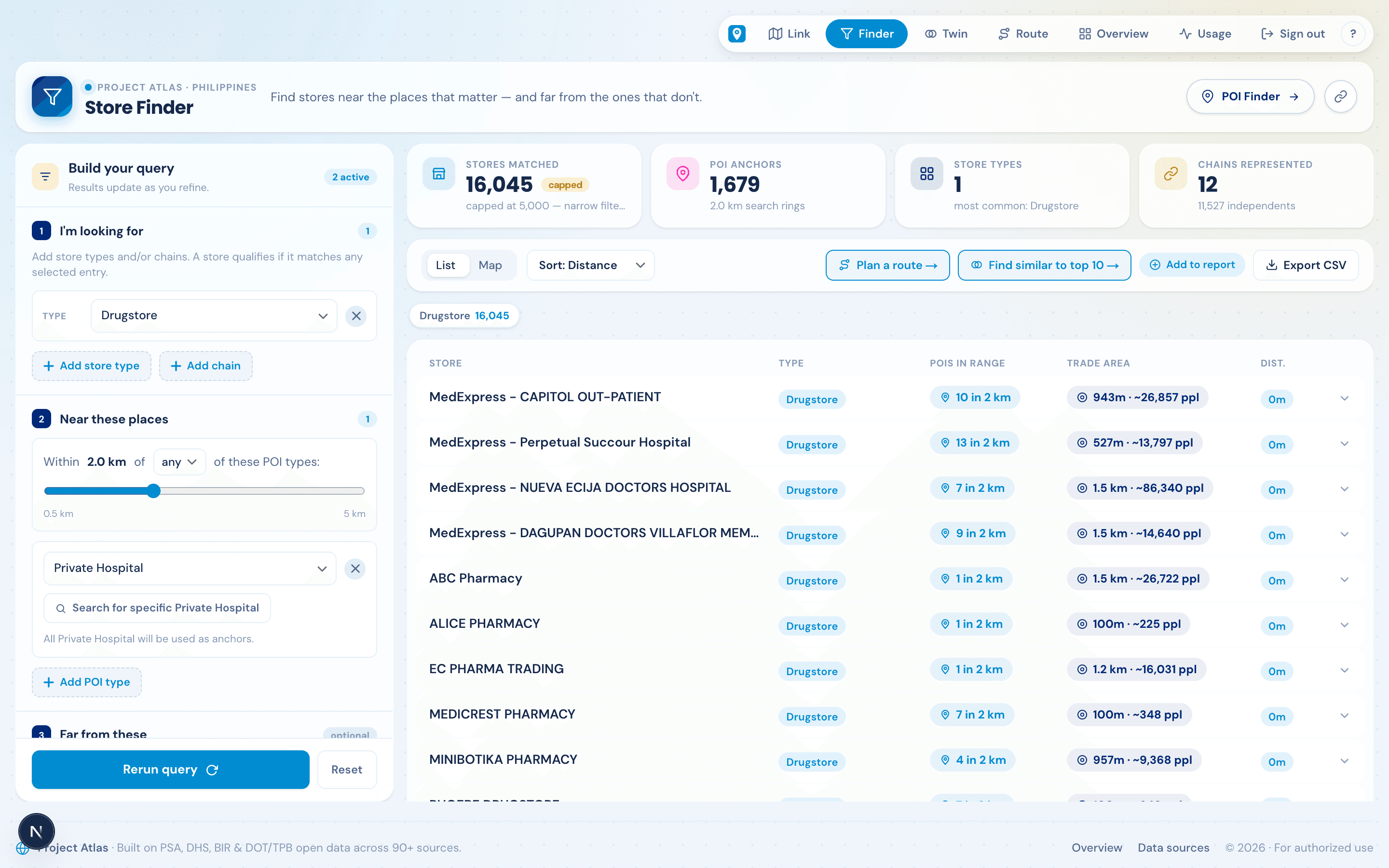
“Which outlets should we be selling to — that we aren't?”
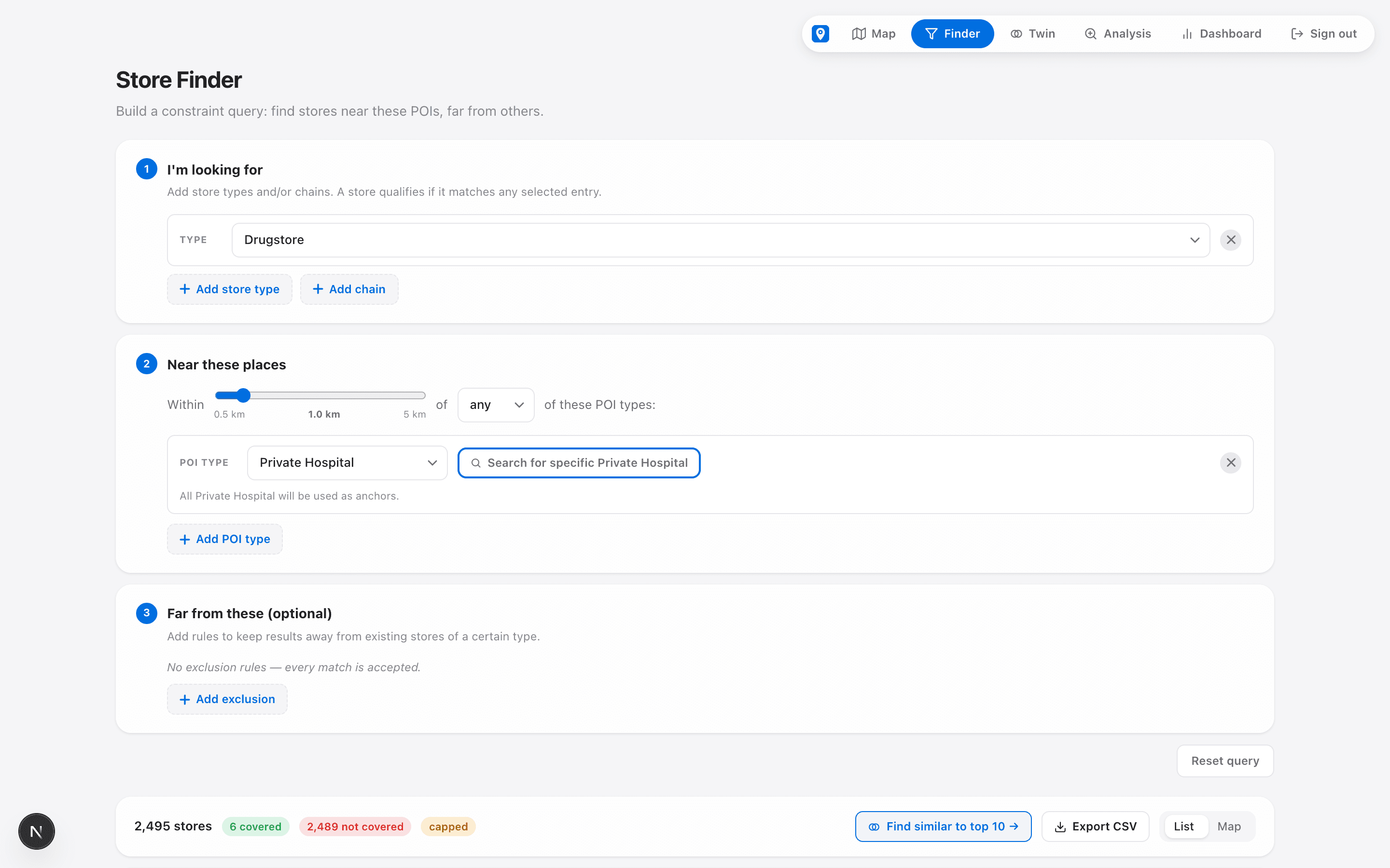
Describe the store you need in plain rules — say, a drugstore within 2 km of a private hospital — and Atlas returns every matching outlet in the country, each with its trade area and the people around it.
- 16,045 matching stores from one query — before lunch, not after a field census.
- Each result carries its POI catchment and trade-area population.
- Export the list, or push it straight into a route plan.
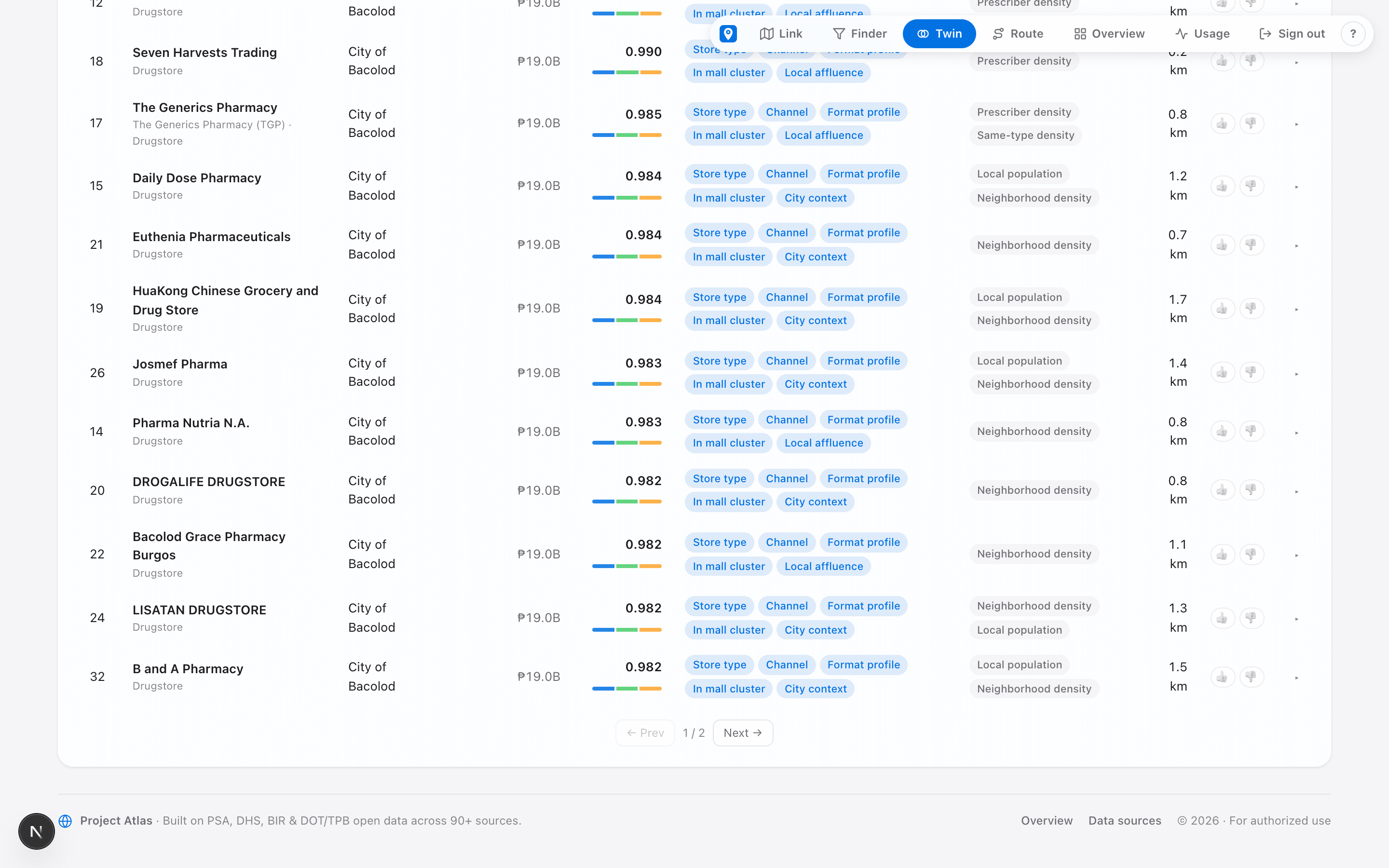
“Where do we find more stores like our best accounts?”
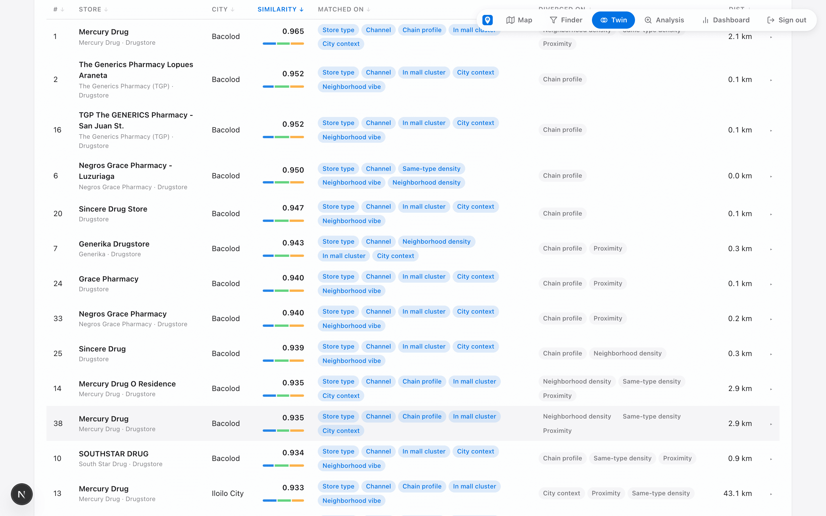
Point Atlas at up to 10 of your proven winners. The Twin engine scores every other store in the country on 74 signals — neighborhood mix, city context, brand profile — and hands back a ranked shortlist.
- Similarity-ranked matches with the reasons spelled out per store.
- Tune what “similar” means: the store, the area, or a balance.
- Expand into a new region with evidence, not a cold start.
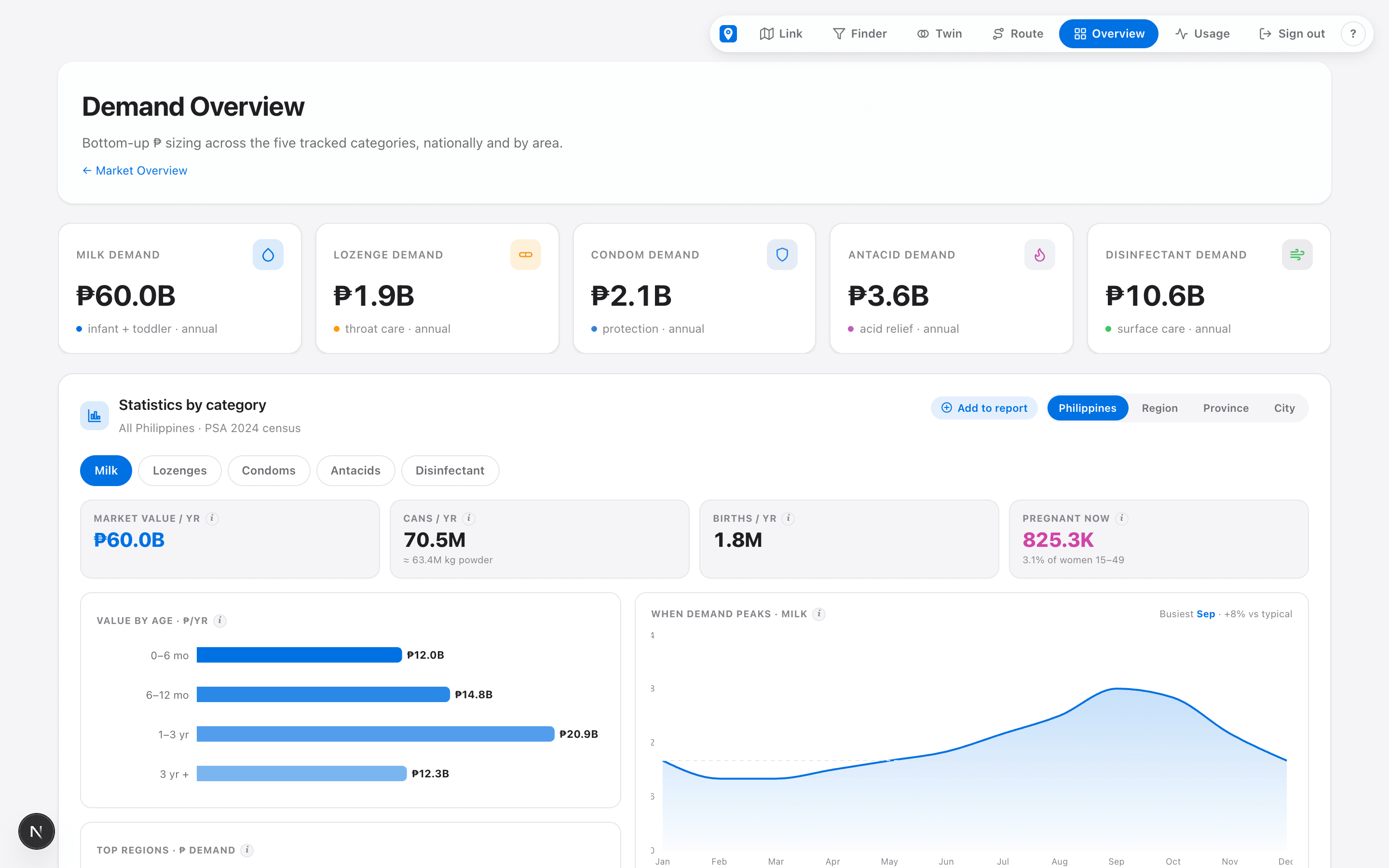
“How big is the demand — city by city?”
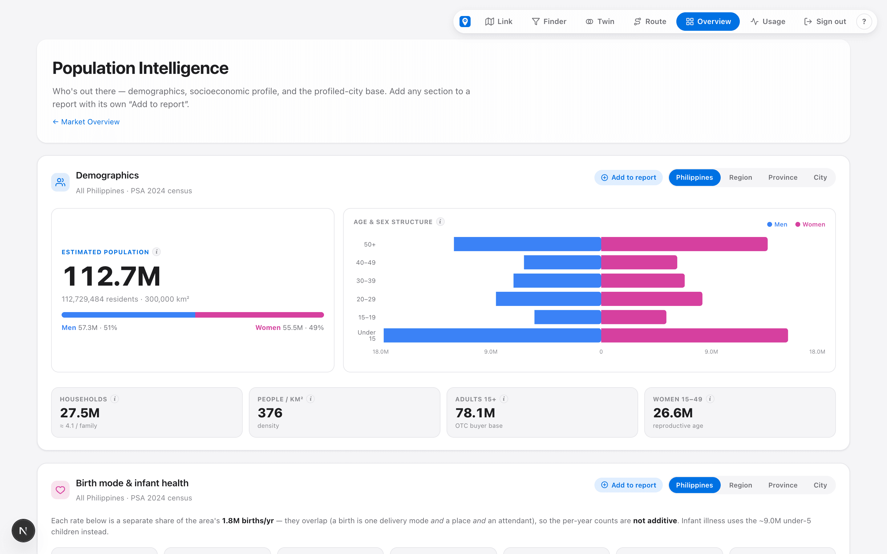
Bottom-up peso demand for your category, built from census population and consumption evidence — national, regional, and per city. Then open the same area on the map and see exactly who lives there.
- ₱ demand per category with region and city drill-down.
- Demographics, income and affluence for any catchment you draw.
- Back every distributor or headcount call with numbers on the table.
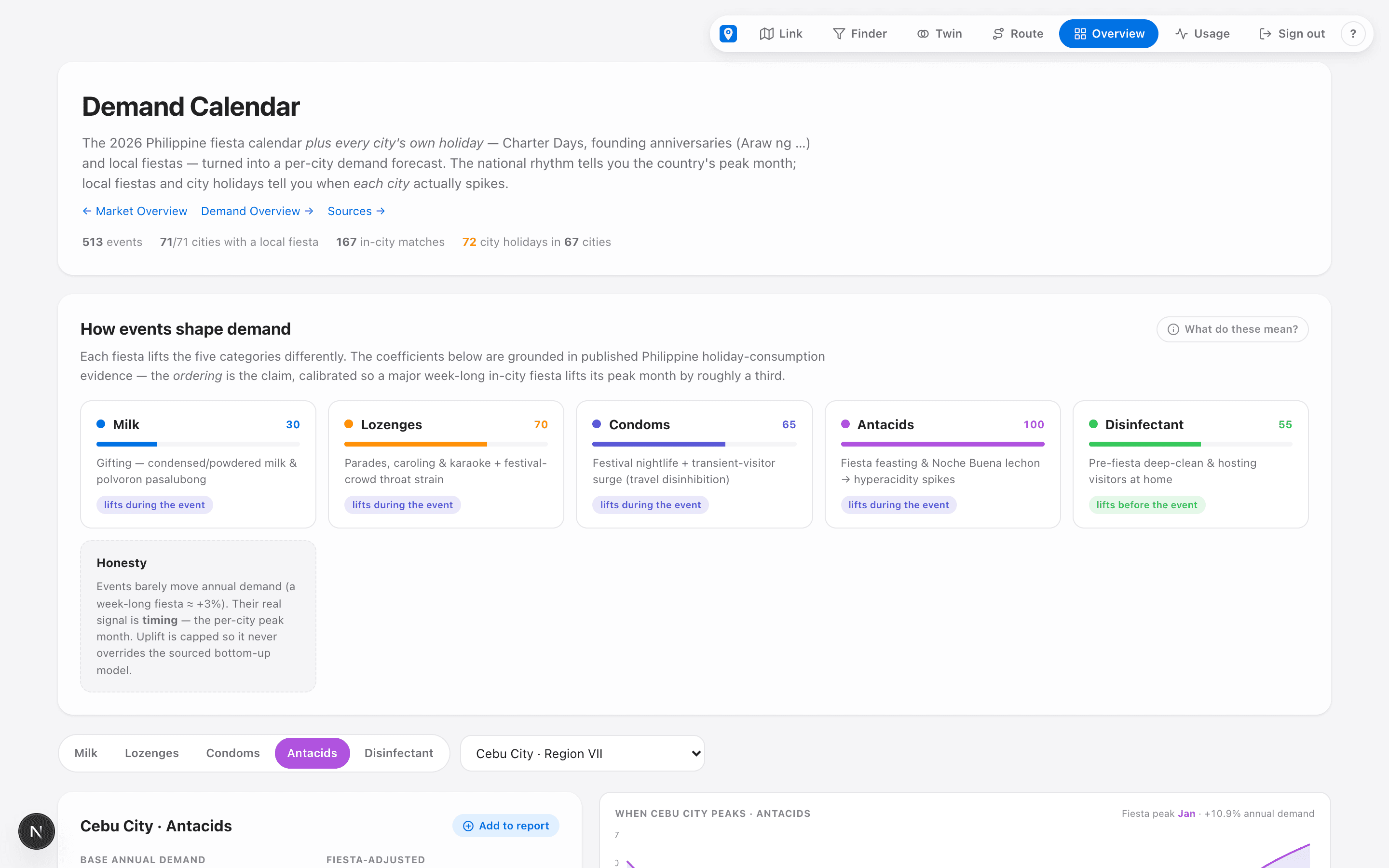
“When does each city actually peak?”
The 2026 fiesta calendar, city holidays and long weekends — turned into a per-city demand forecast. The national rhythm tells you the country's peak month; local fiestas tell you when each city spikes.
- 513 events across all 71 profiled cities, category by category.
- Time promos and stock-up to the week, not the quarter.
- Honest modelling — uplift is capped, sources are cited.
“Can our team actually cover it — and at what cost?”
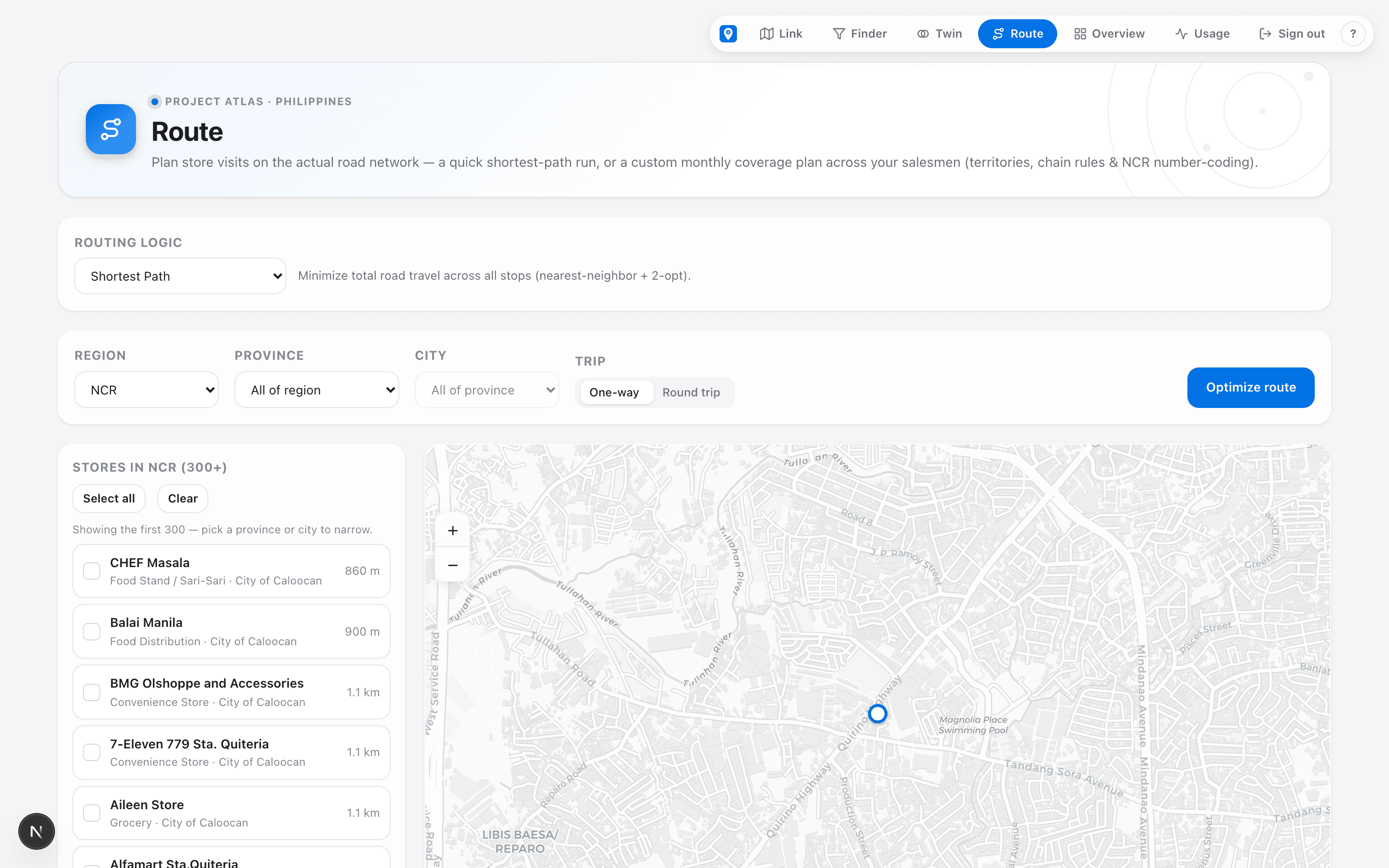
A store list only grows sales if someone visits it. Atlas Route builds monthly coverage plans across your salesmen — territories, chain rules, NCR number-coding — on real road distance, then prices the route in pesos.
- Balanced monthly visit schedules for up to 30 salesmen.
- Shortest-path daily runs on the actual road network.
- Cost-to-deliver per route — fuel, manpower, break-even sales.
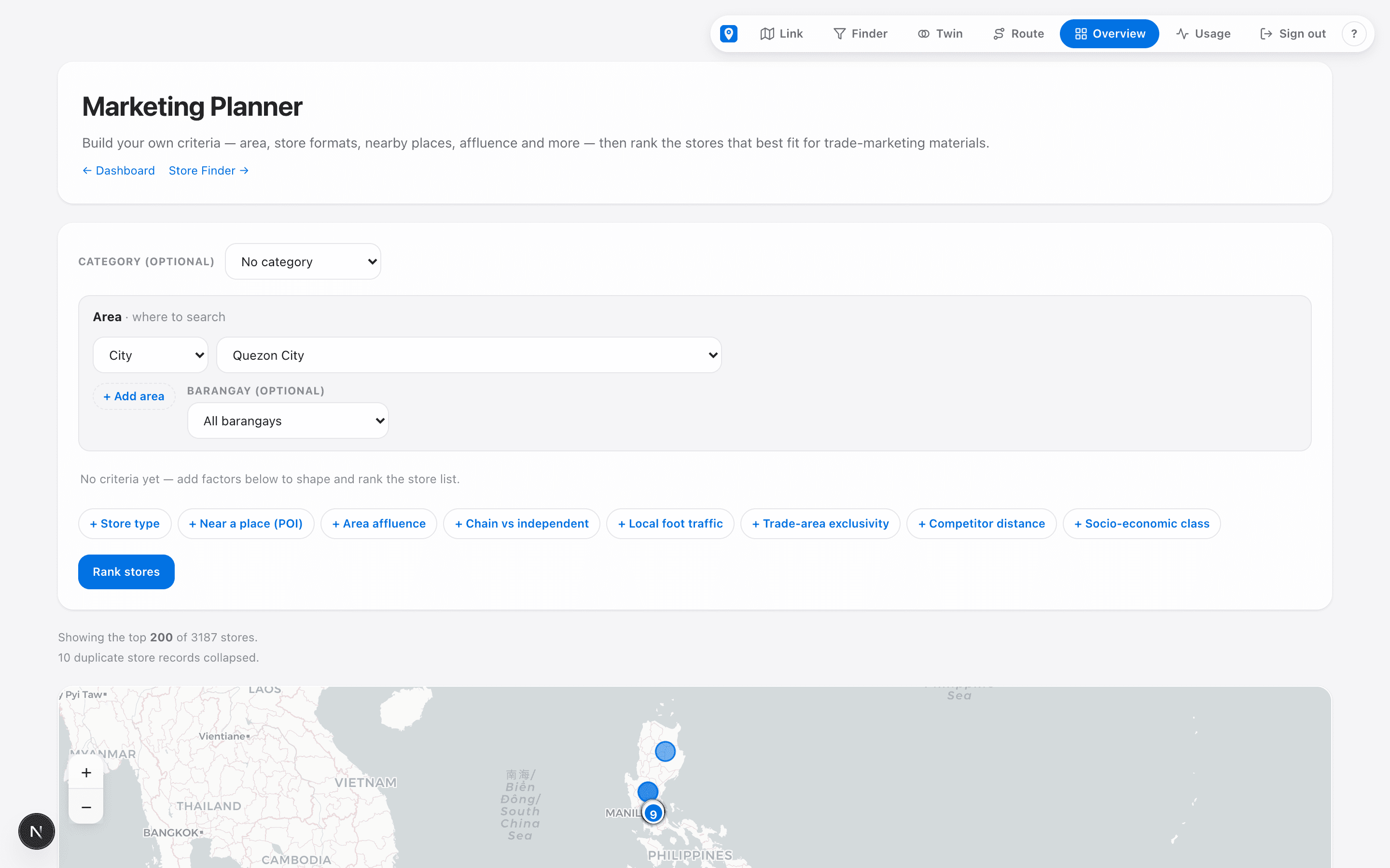
The follow-through is in the same tab.
Start with your goal. Atlas hands you the playbook.
Every goal below maps to an ordered set of Atlas tools and the steps to run them — the same catalog your team uses inside the app.
Try it yourself — free.
Frequently asked questions
What is Project Atlas PH?
Project Atlas PH is a location-intelligence platform for Philippine retail, FMCG, and pharma teams. It maps 119,074 stores and 113,914 points of interest across all 17 regions so teams can choose store locations with data instead of gut feel.
What does Project Atlas cover in the Philippines?
All 17 regions, with 119,074 mapped retail stores and 113,914 points of interest, classified by trade channel — modern, traditional, pharma, and wholesale.
What can I do with Project Atlas?
Three tools: Atlas Link shows every store and competitor around any location; Atlas Find surfaces retail whitespace by custom criteria; Atlas Twin ranks locations that look like your best-performing stores.
Who is Project Atlas for?
Retail expansion, FMCG distribution, and pharmacy/pharma teams making store-location and trade-coverage decisions in the Philippines.
How can I expand distribution coverage in the Philippines?
Map your current accounts against all 119,074 stores in Project Atlas to see which outlets you don't yet reach, rank them by demand, and add them to your reps' coverage — growing numeric distribution outlet by outlet instead of guessing.
How do I find untapped retail outlets?
Atlas Find surfaces distribution whitespace — outlets in a territory that match your target profile but aren't yet covered — so sales and distribution teams can prioritise the highest-value new accounts.
Can Project Atlas plan sales territories and rep routes?
Yes. Atlas Route turns a list of outlets into balanced sales territories and an efficient rep journey plan using real road distance, so coverage expansion stays workable on the ground.
How is it different from Google Maps?
Google Maps shows places; Atlas classifies stores by trade channel, scores trade areas, finds uncovered demand, and ranks lookalike sites — analysis a plain map cannot do.
Your next distribution points are already on the map.
Stop guessing where to grow. See the untapped outlets, size the demand, and plan the coverage — with the whole map behind you.